The Crack at Wet Beaver Creek
Bell Trail, Rimrock, AZ 86335, USAOverview
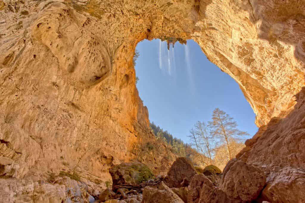
The Crack at Wet Beaver Creek is a narrow slot canyon hike in central Arizona, located about 15 minutes south of Rimrock in Yavapai County. The canyon's defining feature is a tight, rocky passage carved by water over millennia, where canyon walls close in dramatically and hikers must navigate through sections that feel almost claustrophobic. This is not a gentle stroll through open desert. The hike demands scrambling over boulders, wading through water, and sometimes squeezing through spaces where your shoulders nearly touch both sides of the stone.
The route follows Wet Beaver Creek upstream from the Bell Trail trailhead, moving from relatively open creek bed into progressively tighter canyon terrain. Most people visit to experience the physical challenge and the unusual intimacy of being wrapped inside a canyon rather than viewing it from above. The creek is usually flowing, though water depth and flow rate vary with season and recent rainfall.
Why this place matters
Slot canyons are uncommon in Arizona outside the sandstone country of the Colorado Plateau, making this limestone and granite version distinctive. The Crack represents a different geology and hiking experience than the famous red-rock slots further north. It's popular among hikers and scrambling enthusiasts specifically because it requires more engagement with the environment than a typical trail. You're not walking on a maintained path; you're problem-solving your way through a natural obstacle course.
The site also sits within a functioning riparian zone, one of Arizona's rarest ecosystems. Wet Beaver Creek supports vegetation and wildlife that depend on permanent water in a state dominated by aridity.
Quick facts
- Location: Bell Trail trailhead, about 15 minutes south of Rimrock, Arizona
- Distance: Roughly 3 to 4 miles round trip to reach the tightest sections
- Elevation gain: Minimal, roughly 200 to 300 feet
- Difficulty: Moderate to difficult scrambling; not a hiking trail in the conventional sense
- Water: Permanent creek flow; expect to get wet
- Best season: Fall through spring; summer heat can be intense in the canyon
- No entry fee or permit required
- Parking: Small lot at Bell Trail trailhead
Getting there
From Rimrock, head south on Forest Road 708 (sometimes called Bell Trail Road). The road is unpaved but typically passable for standard vehicles, though clearance matters after heavy rain. The trailhead parking area is small and unsigned, so attention to landmarks helps. You'll know you're in the right place when you see the creek access and hikers heading upstream.
Cell service is unreliable or absent at the trailhead, so plan your route before arriving. The nearest town with services is Cottonwood, roughly 30 minutes north.
The layout and experience
The hike begins at the Bell Trail trailhead and immediately follows Wet Beaver Creek upstream. For the first 15 to 20 minutes, the canyon is relatively open. The creek bed is rocky and the surrounding canyon walls are visible but not towering. This section is straightforward creek walking.
As you continue upstream, the canyon narrows. Boulders become more frequent and larger. You'll move from walking on the creek bed to clambering over and sometimes around boulders. The water grows deeper in spots, and you'll transition from dry crossings to wading. By the time you reach the section known as "the Crack," the canyon walls have closed in significantly, and you're moving through a space that feels much more confined.
The tightest sections of the canyon require scrambling and sometimes squeezing through gaps. This is where the hike becomes technical. You cannot move quickly here. Handholds matter, footing must be deliberate, and if you're claustrophobic, this is where you'll feel it most acutely. The walls are wet and slimy in places, especially during wetter months.
Most hikers turn around within the canyon rather than pushing to a definitive endpoint. The canyon continues upstream, but access becomes increasingly difficult, and many people reach a point where they decide to head back.
Main highlights
The primary draw is the sensation of being inside the canyon itself. Unlike many Arizona hikes where you move through landscape, here the landscape contains you. The stone walls, the sound of water echoing off granite and limestone, the shade and cool air in the canyon bottom on a hot day—these create a fundamentally different hiking experience.
The creek itself is a constant presence. Depending on season, you might wade through knee-deep water in certain pools, or step across shallow flows in other sections. The creek and the canyon have carved each other over geological time, and you experience that relationship directly.
The difficulty and technical nature of the hike also filter the crowd. You won't encounter the volume of people you'd find on mainstream Arizona trails, which means the canyon maintains a quieter, more solitary feeling even during peak seasons.
Best time to visit
Fall and winter offer the most comfortable hiking conditions. Temperatures are moderate, water flow is typically consistent, and the risk of flash flood is lower (though never zero when water is flowing). October through March is the sweet spot.
Spring can be good as well, though water levels may be higher from snowmelt, making some passages more challenging. Summer is hot inside the canyon but still possible; however, heat exhaustion risk increases, and afternoon thunderstorms pose a genuine flash-flood hazard.
After heavy rain, the creek swells and the hike becomes significantly more difficult or impassable. Check conditions locally before committing to the drive.
Facilities and preparation
The Bell Trail trailhead has minimal infrastructure. There is a parking area, but no restrooms, water, or shade structures. Bring everything you need with you.
Footwear is critical. You need shoes with good grip on wet rock and adequate ankle support for scrambling. Water shoes or hiking sandals are common choices, though some hikers use trail runners. Avoid smooth-soled shoes or sandals without straps.
A small backpack with water, snacks, and a basic first-aid kit is standard. The hike is short enough that you don't need elaborate supplies, but the technical scrambling means a twisted ankle is a real possibility. A headlamp or flashlight is useful if you're hiking in cooler months when daylight ends earlier, or if you misjudge your timing. The canyon can feel very dark in the tightest sections.
Bring a change of clothes or at least a dry shirt if you're sensitive to cold. You will get wet. Even if water levels are low, splash and seepage are inevitable.
Combining with nearby attractions
Wet Beaver Creek itself has other access points and trails in the area. The creek runs for several miles, and depending on your interests and fitness level, you can explore other sections or combine this hike with nearby Forest Service trails.
Cottonwood, the nearest town, sits at the base of the Mingus Mountains and offers access to other hiking in the area. If you're spending a full day in the region, you could combine the Crack with a visit to nearby trails or the town's modest downtown area with galleries and local restaurants.
Sample visit plan
Start early, ideally arriving at the Bell Trail trailhead by mid-morning. This gives you daylight to navigate the more technical sections and time to spend in the canyon without rushing. Allow 3 to 4 hours total for the round trip hike, including time to scramble and navigate the narrower sections.
Pack water and a light snack. The hike is short enough that you won't need a full meal, but you'll be moving your body and will appreciate fuel. Bring a change of clothes in your car, not your pack, so you have something dry to change into afterward.
Plan to be off the creek and back at the trailhead by mid-afternoon. This ensures you have daylight to drive back to Rimrock or Cottonwood, and you avoid hiking in the canyon as light fades.
Practical tips
- Scout the weather before you go. Any significant rain in the preceding 24 hours can raise water levels and create hazardous conditions.
- Go with at least one other person. If someone gets injured in a remote canyon section, solo hiking makes rescue and communication much harder.
- Test your footing before committing your full weight to wet rocks. Limestone and granite are slippery when wet.
- If you feel uncertain about a passage, turn back. The hike doesn't require you to push into sections that make you uncomfortable.
- Bring a waterproof bag or dry bag for phone, keys, and anything that shouldn't get wet.
- Don't attempt this hike if you have significant knee or ankle issues. The scrambling is repetitive and demanding.
- Watch for flash flood risk if storms are in the forecast. Wet Beaver Creek is a drainage, and water moves fast in a confined space.
FAQ
How wet do you actually get? You will get wet. Depending on season and water levels, you might wade through sections where water reaches your knees, or you might scramble over mostly dry rocks with occasional splashes. Plan to be soaked.
Is this hike suitable for families with children? It depends on the child's age and scrambling ability. The technical sections are challenging for young kids, and the water can be cold. Children under 10 or without prior scrambling experience will likely struggle.
Can you do this hike year-round? Technically yes, but summer heat and flash-flood risk make it less ideal. Fall through spring is strongly preferred.
Do you need hiking experience to do this? You should be comfortable scrambling and moving over uneven, wet terrain. This isn't a beginner's hike, despite the short distance.
Opening hours
Reviews
Sign in and mark this place visited to leave a review.
No reviews yet.
Free Trip Planner
Plan your Yavapai County trip with our free planner
Build a day-by-day itinerary with AI suggestions, hand-picked places, and friends. Free forever — no credit card.