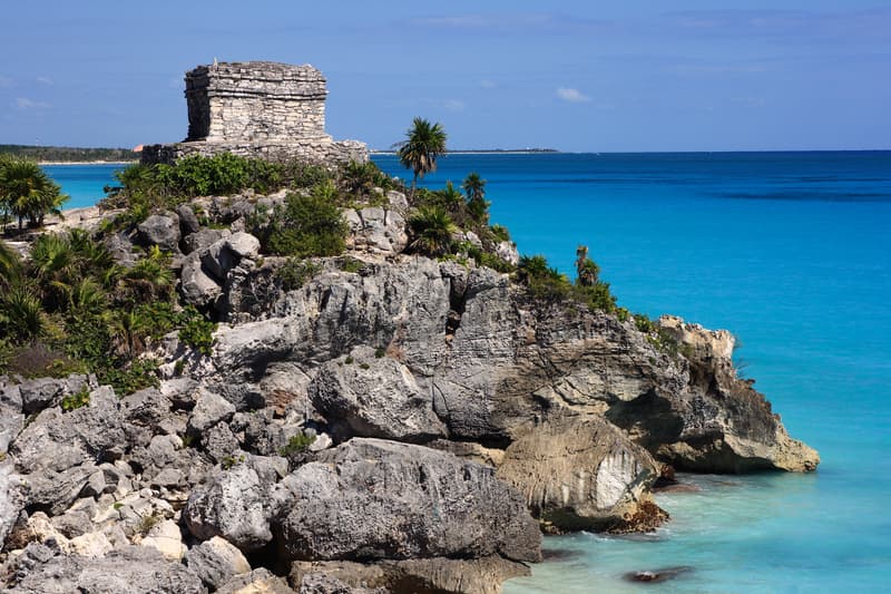
Zona Arqueologica de Coba
Carretera Federal Tulum 307, Coba 77793 Mexico Posted by Brandon B.Admin
Overview
Zona Arqueologica de Coba stands as one of Mexico's most significant pre-Columbian sites, sprawling across 80 square kilometers of jungle in the Yucatan Peninsula. Unlike the more compact and manicured ruins at nearby Tulum, Coba rewards explorers willing to venture into thick forest and climb its tallest pyramid. The site was a major Maya city from roughly 100 CE to 1500 CE, and what you see today is only a fraction of its original extent. Most structures remain unexcavated, buried beneath centuries of jungle growth, which gives the place an authentic, less-touristed feel.
The name Coba likely comes from the Maya words meaning "water ruffled by wind," a reference to the five lakes that surround the site. These lakes were essential to the city's survival in a region where underground cenotes are scarce. Walking through Coba, you move between cleared pyramids and restored ball courts while the forest constantly reminds you that this is archaeology in progress, not a finished museum.
Why This Place Matters
Coba was a crucial trading hub connecting the Caribbean coast to inland Maya cities. Evidence of this importance appears in the sacbeob, or white stone roads, that radiate outward from the site for distances up to 100 kilometers. These elevated causeways allowed merchants and travelers to move through swampy terrain, and fragments of them are still visible today.
The pyramid known as Nohoch Mul, at roughly 42 meters tall, remains the tallest structure in the Yucatan Peninsula. Climbing it offers both a physical challenge and a visceral sense of how the ancient Maya engineered such monuments without wheeled vehicles or metal tools. The view from the summit extends across unbroken jungle canopy, a perspective few travelers experience in such proximity to a major archaeological zone.
Quick Facts
- Location: Carretera Federal Tulum 307, about 45 kilometers northwest of Tulum town and 130 kilometers south of Cancun
- Site size: 80 square kilometers, though only about 5 percent has been excavated
- Nohoch Mul pyramid height: approximately 42 meters, the tallest in the Yucatan
- Active occupation period: roughly 100 CE to 1500 CE
- Main features: pyramids, ball courts, sacbeob (white stone roads), five lakes
- Best visited: early morning to avoid crowds and heat
- Typical visit duration: 3 to 4 hours
Getting There
Coba sits inland from the Caribbean coast, accessible via Carretera Federal 307. If you're staying in Tulum, the drive takes roughly 45 minutes heading northwest. The road is well-maintained, and signs point clearly toward the archaeological zone from the highway. A rental car gives you the most flexibility, especially if you want to explore at your own pace or stop at the small town of Coba nearby.
Organized tours from Tulum, Playa del Carmen, and Cancun typically include hotel pickup and transportation. These tours often bundle Coba with other nearby sites like Xel Ha or Laguna Kaan, though this can mean less time to properly explore Coba itself. If you rely on public transportation, colectivos (shared vans) run from Tulum to Coba town, and from there you'll need to arrange a local taxi to reach the entrance.
The entrance gate sits about 2 kilometers from the main plaza area. Many visitors park near the entrance and either walk or rent bicycles for exploring the site. The internal distances are significant enough that walking the entire zone without breaks becomes tiring in the heat.
The Layout and Experience
The site is not laid out as a single compact cluster. Instead, multiple ceremonial groups are scattered throughout the jungle, connected by ancient roads and modern pathways. The main entry point leads you toward the central plaza area, where the most visited structures concentrate. From here, paths branch outward to smaller groups of pyramids, ball courts, and ceremonial platforms.
Nohoch Mul dominates the eastern portion. The climb involves steep stone steps, and the ascent takes most visitors 10 to 15 minutes depending on fitness level. The pyramid narrows as you climb, and the final section requires careful footing. Once at the summit, you stand above the jungle canopy with views extending to the lakes and distant forests. This vantage point illustrates why the ancient Maya chose this location: it offered visibility and access to water in an otherwise flat landscape.
The ball court near the main plaza is one of the larger examples in the region. These courts served both recreational and ceremonial functions, and the stonework shows careful engineering to create the narrow playing field. Smaller pyramids and platforms dot the surrounding area, many still partially covered in vegetation and restoration rubble.
Walking between groups means moving through sections of cleared jungle. Depending on recent maintenance, some paths are well-defined while others require you to navigate more carefully. This is part of Coba's appeal: you feel like an explorer rather than a tourist following a marked route.
Main Highlights
Nohoch Mul is the obvious focal point and the structure most visitors prioritize. The climb itself is the main experience here; the pyramid is less decorated than some other Yucatan structures, but its height and isolation make it memorable.
The sacbeob network is less visible than at other sites, but sections of these white stone roads remain intact. They demonstrate the sophistication of Maya engineering and planning. If you ask a site guide, they can point out fragments that show how these roads were constructed and maintained.
Macanxoc Group, on the western side of the site, contains stelae and altars with glyphic inscriptions. These carved stones record dates and dynastic information, making them valuable to archaeologists studying Maya civilization. The group is less crowded than central areas.
The five lakes that gave Coba its name are scattered around the site. They're not always easily accessible from the main paths, but their presence shaped the city's development and survival. In the dry season, water levels drop significantly.
History and Background
Coba emerged as a settlement around 100 CE and grew into a major power by the Classic Maya period (250 to 900 CE). Archaeological evidence suggests it was an important hub for trade networks connecting the Caribbean coast, inland Yucatan, and even distant regions. The site reached its peak around 600 to 900 CE, after which it declined along with other Classic Maya cities in the region.
Unlike some Maya sites that were abandoned entirely, Coba continued to be occupied through the Postclassic period (900 to 1500 CE) and into the early Spanish colonial era. This extended occupation history means the site contains architectural layers from different periods, though excavations have only begun to untangle these sequences.
Spanish conquistadors and missionaries documented Coba in the 16th century, but the site was largely forgotten as the jungle reclaimed it. Serious archaeological work didn't begin until the mid-20th century. Much of what we know comes from investigations conducted from the 1970s onward, and excavations continue today.
Tickets and Entry
General admission tickets grant access to the entire archaeological zone. Timed entry is not required, so you can arrive and depart on your own schedule. Children under a certain age may receive discounted or free entry, though policies change and you should confirm current rates before visiting.
Guided tours are available at the entrance. A guide can provide context about the structures, point out details you might miss, and explain the ongoing excavation efforts. Guides speak Spanish and English, and tours typically last 2 to 3 hours depending on your pace and interests.
The site operates during daylight hours only. Gates close by late afternoon, so plan your arrival accordingly if you want time to climb Nohoch Mul and explore other areas without rushing.
Best Time to Visit
Early morning, ideally by 8 or 9 AM, is ideal. Temperatures are cooler, humidity is lower, and you'll encounter fewer tourists. The site is popular enough that arriving later means navigating crowds on popular structures like Nohoch Mul.
The dry season from November through April offers more comfortable conditions for walking and climbing. During the wet season from May to October, afternoon rain is frequent, and paths become muddy. The jungle is greener and more alive during rainy months, but the weather makes exploration harder.
Avoid midday heat if possible. Even in cooler months, the sun is intense at noon, and shade is limited in open areas. Most visitors find late afternoon exploration less rewarding due to fatigue and deteriorating light for photographs.
Photography Tips
The summit of Nohoch Mul offers sweeping views of jungle canopy, especially effective during golden hour in late afternoon when the light is warm and directional. Wide-angle lenses work well to capture the scale and surrounding landscape.
Detailed carvings on stelae and altars photograph best with sidelighting that emphasizes shadows and texture. Midday overhead sun flattens these details. If you want to capture glyphic inscriptions, overcast conditions often work better than harsh sun.
The jungle setting itself is photogenic. Thick trees frame many structures, creating natural composition. Paths through dense vegetation offer leading-line shots if you're patient enough to wait for good light angles.
Bring a polarizing filter to reduce haze in jungle shots and deepen blue sky. A sturdy tripod is impractical for this site, but a small monopod can help stabilize longer exposures if you're using slower film or high ISO.
Facilities and Preparation
The site has minimal facilities. There's a small visitor center near the entrance with restrooms and a gift shop. Food and water are available but limited in variety and selection. Bring plenty of water, at least 2 to 3 liters per person depending on the season and your activity level.
Wear sturdy footwear with good traction. Stone steps on pyramids are uneven and can be slippery when wet. Many visitors wear hiking boots or trail shoes. The terrain is generally dry except during or immediately after rain, but tree roots and uneven ground are common on connecting paths.
Sunscreen, insect repellent, and a hat are essential. The jungle canopy provides some shade, but exposed areas like pyramid summits offer no protection. Mosquitoes and biting insects are present, especially near the lakes and in humid areas.
Lightweight, breathable clothing is best. Long sleeves and pants offer protection from sun and insects, though many visitors opt for shorts and accept the trade-off. A light rain jacket is useful during the wet season.
How It Compares to Similar Places
Coba is larger and less excavated than Tulum, which lies about 45 kilometers to the southeast. Tulum's structures are more ornate and its setting perched on a Caribbean cliff is dramatic, but Tulum feels more curated and touristy. Coba rewards those willing to spend time hiking through jungle for a more immersive archaeological experience.
Compared to Chichen Itza further north, Coba is smaller and less famous. Chichen Itza has more fully restored structures and clearer historical narratives, making it more accessible to casual visitors. Coba offers a rawer, less-polished encounter with Maya archaeology.
Muyil, another nearby site, is smaller and less visited than either Coba or Tulum. If you want an even more remote experience, Muyil might appeal, but Coba offers a better balance of scale, significant structures, and manageable crowds.
Combining with Nearby Attractions
Tulum is close enough to visit on the same day. A typical itinerary might combine early morning at Coba with mid-afternoon at Tulum, allowing time for lunch in Tulum town between the two. The drive is straightforward and takes less than an hour.
The cenotes around Coba and Tulum are worth exploring. Cenote Dos Ojos, about 30 kilometers from Coba, offers swimming and snorkeling in crystal-clear freshwater pools. Cenote Calavera, near Tulum, is another popular option. These provide a refreshing contrast to archaeological exploration.
The Sian Ka'an Biosphere Reserve, south of Tulum, protects a vast area of coastline, wetlands, and forest. Day trips into the reserve offer wildlife viewing and a sense of the landscape that surrounded ancient Maya cities. Boat tours depart from nearby towns.
Laguna Kaan, a coastal lagoon, is sometimes included in packaged tours alongside Coba. It's less impressive than Sian Ka'an but offers a quick water-based activity if your schedule is tight.
Sample Visit Plan
A full day visit allows you to see most of the main structures without excessive rushing. Arrive by 8 AM to beat crowds and heat. Spend your first hour exploring the central plaza and ball court, getting oriented to the layout.
By 9 AM, head toward Nohoch Mul and climb the pyramid. Spend 30 to 45 minutes at the summit taking in views and photographs. The descent is easier than the ascent and takes about 10 minutes.
From 10 AM onward, explore secondary groups like Macanxoc on the western side. Wander the connecting paths and examine smaller pyramids and platforms. Stop frequently to rest and hydrate. By noon, most visitors find the heat and fatigue catching up, making this a good time to head back toward the entrance.
If you're staying overnight in Coba town or nearby, an afternoon return to the site during late afternoon light can yield good photographs without the midday crowds. Otherwise, use early afternoon to visit a cenote or head toward Tulum.
Practical Tips
- Rent a bicycle at the entrance if you want to cover more ground efficiently without walking between distant groups
- Bring cash for entrance fees, bicycle rentals, and purchases at the visitor center; card payment may not be available
- A site guide is worth the investment if you're interested in archaeology or want detailed historical context
- Climb Nohoch Mul early in your visit while you have energy; the ascent is strenuous and better attempted fresh
- Stay on marked paths to avoid disturbing unexcavated areas and getting lost in dense jungle
- Download offline maps or take photos of site maps before arriving; cell service is unreliable
- Visit in early morning or late afternoon for better light and fewer crowds; avoid midday whenever possible
- Wear sturdy closed-toe footwear, not sandals; pyramid steps are steep and unforgiving
FAQ
How long does it take to see Coba? Most visitors spend 3 to 4 hours exploring the main structures and climbing Nohoch Mul. You could spend more time if you're interested in walking to outlying groups or returning for afternoon photography. Plan for at least a half day.
Is climbing Nohoch Mul difficult? The climb is steep and the steps are uneven, but it's manageable for most people in reasonable fitness. The ascent takes 10 to 15 minutes. Those with knee problems or significant mobility issues may find it challenging. There's no age limit, and children often climb successfully with adult assistance.
Can I visit Coba and Tulum on the same day? Yes. They're about 45 kilometers apart. Many organized tours combine them, and independent travelers can easily drive between them. An early start at Coba and mid-afternoon at Tulum is a realistic schedule.
Are there accommodations at Coba? The small town of Coba has basic hotels and guesthouses, but they're modest by tourist standards. Most visitors stay in Tulum, which has far more lodging options and restaurants. The drive from Tulum is less than an hour.
Is Coba worth visiting if I'm short on time? If you only have one day for Maya archaeology in the Riviera Maya, Tulum might be more efficient because it's smaller and closer to coastal amenities. Coba rewards those with at least a half day and interest in exploring less-curated ruins. If you're spending 3 or more days in the area, Coba is worth prioritizing.
Opening hours
Reviews
Sign in and mark this place visited to leave a review.
No reviews yet.
Free Trip Planner
Plan your Coba trip with our free planner
Build a day-by-day itinerary with AI suggestions, hand-picked places, and friends. Free forever — no credit card.
Things to see near Zona Arqueologica de Coba
Amansala Resort Beachclub and Spa

Avenida Kukulkan

Tulum Archaeological Site