
Exploring Mountain Roads and Small Towns in Utah
By
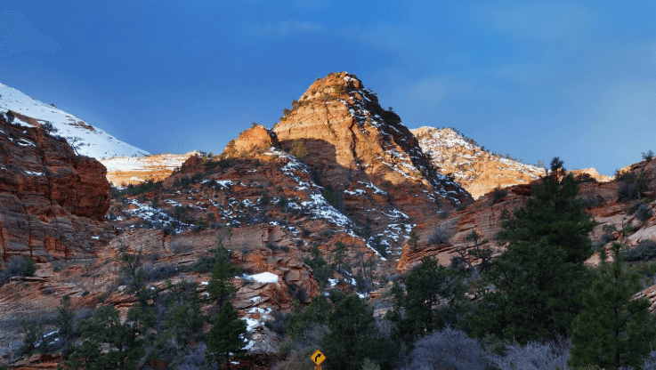
Utah's famous parks pull in the crowds, but the roads between them often make the better memories. In 2024, 15.8 million visitors to Utah's national parks spent $2.0 billion statewide, according to the National Park Service, and much of it flowed into small gateway towns along two-lane highways. Those highways climb past alpine lakes, wind through red rock, and in some cases close for half the year.
Which byways earn the miles, when are they open, and how do you link quiet towns into a drive that works? This guide answers those questions with named routes, town stops, sample plans, and safe driving habits.
Best Scenic Drives in Utah for Your Road Trip
For most travelers, five roads offer the best mix of views and easy access: the Mirror Lake Highway, the Alpine Loop, Logan Canyon, Scenic Byway 12, and Highway 24 near Capitol Reef. Two hours or less from Salt Lake City puts you on the first three, which climb through the northern mountains, whereas the final pair run through southern canyon country.
Many of the northern drives start from the Park City and Heber Valley area, east of Salt Lake City. Before heading up into the mountains, travelers can use this area as a base, since it offers gas, places to sleep, and mechanics.
A quick vehicle check before steep grades is a sensible habit. Park City is home to a franchised chevy dealer utah drivers use for vehicle sales and routine service. Tires, brakes, and fluids can be checked there or at any trusted shop.
Wasatch and Uinta Mountain Byways
Mirror Lake Highway (SR-150): Running about 78 miles from Kamas to the Wyoming line, it peaks near 10,700 feet at Bald Mountain Pass.
Alpine Loop (SR-92): Roughly 20 narrow miles linking American Fork Canyon and Provo Canyon, at its best during late September aspen season.
Logan Canyon (US-89): About 40 miles from Logan to Garden City, ending with a wide view of Bear Lake.
Southern Utah Canyon and Plateau Routes
Scenic Byway 12: About 123 miles from US-89 near Panguitch to Torrey, passing Bryce Canyon, Escalante, and Boulder.
Highway 24: Roughly 50 miles from Torrey to Hanksville through Capitol Reef National Park, with cliffs, orchards, and rock art near the road.
When Utah Mountain Roads Open and Close
Altitude decides the season on most Utah mountain roads. The highest stretches of the Mirror Lake Highway and the Alpine Loop usually close to through traffic from late fall until late spring, often reopening around Memorial Day. Logan Canyon, Byway 12, and Highway 24 sit lower and remain open year-round, with only short weather shutdowns now and then.
Route | Approx. Length/Drive Time | Best Season | Road Difficulty | Nearby Town Stop |
|---|---|---|---|---|
Mirror Lake Highway | 78 miles / 2 to 3 hours | Late June to October | Moderate, high altitude | Kamas |
Alpine Loop | 20 miles / 1 hour | Late May to October | Hard, tight switchbacks | Midway |
Logan Canyon | 40 miles / 1 hour | Year-round | Easy to moderate | Garden City |
Scenic Byway 12 | 123 miles / 3 to 4 hours | April to October | Moderate, exposed ridges | Boulder |
Highway 24 | 50 miles / 1 hour | March to November | Easy | Torrey |
Where to Stop: Small Towns in Utah by Region
Services thin out quickly once you leave the main valleys. Grouping towns by region makes fuel, meals, and beds much easier to plan.
Towns in the Mountains Around Park City
Heber City: The main service hub, with groceries, gas, and motels along US-40.
Midway: A calmer village known for Swiss-style buildings and a limestone dome that holds a geothermal pool.
Kamas: Gas up here, because the Mirror Lake Highway offers no complete fuel stop once it heads uphill.
Red Rock Country Towns
Torrey: Where Byway 12 meets Highway 24, with lodging, cafes, and gas.
Boulder and Escalante: Boulder has limited fuel, while Escalante offers motels, a grocery, and trailheads.
Kanab and Springdale: Kanab has full services on US-89, and Springdale sits at the mouth of Zion Canyon.
Sample Itineraries for a Weekend or Five Days
A Weekend Loop From Park City
On day one, fuel up in Kamas and drive the Mirror Lake Highway to the lake and back, then stay in Heber City or Midway. On day two, head down Provo Canyon, cross the Alpine Loop, and return to Park City by interstate.
A Five-Day Southern Utah Byway Drive
Day 1: Salt Lake City to Torrey, about 3.5 hours.
Day 2: Round trip to Capitol Reef on Us Hwy 24
Day 3: Byway 12 over Boulder Mountain to Escalante, about 1.5 hours without stops.
Day 4: Escalante past Bryce Canyon to Kanab, about 2.5 hours.
Day 5: Kanab to Springdale, then north on I-15 home.
Add at least 30 percent to every mapped drive time for photo stops and slow curves.
Practical Mountain Driving Tips and Vehicle Readiness
Handling Steep Grades and Switchbacks
These habits matter most on long descents and narrow passes:
On long descents, drop into a lower gear and let the engine do part of the slowing.
Brake in short, firm bursts instead of riding the pedal, which can overheat brakes.
Pre-Trip Vehicle and Supply Checklist
Wiper blades, brake condition, and fluid levels
A full tank before Byway 12 or the Mirror Lake Highway
Water, snacks, and offline maps, since cell coverage drops in most canyons
During winter storms, canyon roads can require snow tires or chains before drivers may continue.
Common Questions About Utah Scenic Drives
Which Season Works Best for Driving Utah's High-Altitude Roads?
Late spring through early fall is generally the safest window, though timing varies by route. Heavy snow shuts many high passes from about November through May. September brings cooler temperatures and fewer crowds, while summer brings afternoon thunderstorms. Check state road condition reports before departing, since closures shift with each season's snowfall.
Which Preparations Help With Sparse Fuel and Spotty Coverage in Remote Areas?
Top off as soon as the gauge falls under half, because gas stations in rural stretches can sit far apart. Download maps for offline use beforehand, and stash a printed one in the glovebox too. Bring extra water, snacks, a spare tire, and a basic emergency kit, and tell someone back home your route and when you expect to arrive.
How Many Days Should a Traveler Set Aside to Link Several Rural Communities by Car?
Plan on three to five days at minimum if you want an unhurried drive through several towns. Maps make the distances look short, but winding grades, photo stops, and lower speed limits all stretch the drive times well beyond what the numbers suggest. Limit each day to four or five hours behind the wheel, which leaves space for local meals, short walks, and detours that often turn into highlights.
The Bottom Line
Choose a season-appropriate route for a great Utah drive. If you're considering the northern byway and the southern road open, base your days as much on towns with fuel and beds as on sights.
Get your maps downloaded, gas, and road information call the nite before you go. And ensure your brakes and tires are in good shape. Grab a blanket and some water and prepare to go low on the down, because those few habits add up to some peaceful, scenic miles on steep grades and lone stretches that most folks are after.
Tags