East and West Side of the Grand Canyon
Grand Canyon, Arizona 86023, United StatesTwo Sides of the Grand Canyon, and Why the Difference Actually Matters
The Grand Canyon is one of those places that sounds like a cliché until you're standing on the rim with your stomach somewhere near your feet. But deciding which side to visit, the South Rim or the North Rim, the East or West of the park's developed corridors, shapes your entire experience in ways most first-timers don't think about until they arrive. The East and West sides of the Grand Canyon aren't just geographic labels. They're genuinely different trips, with different crowds, different views, different infrastructure, and different reasons to go.
Understanding the distinction before you book saves a lot of backtracking on roads that are longer than they look on any map.
Why This Distinction Matters More Than You'd Think
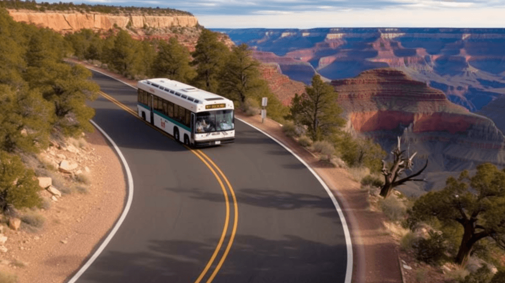
Most visitors default to the South Rim's western corridor around Grand Canyon Village, which sits roughly in the middle of the South Rim but skews toward the western end of the developed area. That's where the main visitor center, the historic El Tovar Hotel, and the bulk of the overlooks cluster. It's also where most of the tour buses go.
The eastern end of the South Rim, reached via Desert View Drive, is a different mood entirely. The road runs about 25 miles from Grand Canyon Village toward the East Entrance, and as you drive it the crowds thin noticeably. Desert View Watchtower, a stone structure completed in 1932 and designed by architect Mary Colter, sits at the eastern end and offers arguably the most dramatic canyon panorama on the South Rim. You can see the Colorado River from here, which you can't from most western overlooks.
Then there's the West Rim, which is a separate situation altogether. The West Rim sits outside Grand Canyon National Park boundaries and is managed by the Hualapai Tribe. This is where the Skywalk, a glass-bottomed horseshoe-shaped bridge extending over the canyon, is located. It requires separate admission and is not part of a National Park pass.
Quick Facts
- The South Rim is open year-round. The North Rim typically closes from mid-November through mid-May due to snow.
- Desert View Drive (East Side, South Rim) runs approximately 25 miles from Grand Canyon Village to the East Entrance Station.
- The West Rim (Hualapai land) is roughly 65 miles from the South Rim entrance and is a separate destination requiring its own ticketing.
- Grand Canyon National Park entry covers the South and North Rims. It does not cover the West Rim or the Havasupai area.
- Hermit Road, which heads west from Grand Canyon Village, is closed to private vehicles most of the year and requires the free park shuttle.
- The canyon is approximately 277 miles long and over a mile deep at its deepest points.
Getting There
For the South Rim's eastern section, the most direct approach is through the East Entrance near Cameron, Arizona, off Highway 64. If you're coming from Page, Arizona, or Monument Valley, this is the natural entry point and drops you almost immediately near Desert View. Coming from Flagstaff, the South Entrance on Highway 64 puts you near Grand Canyon Village, and you drive east from there.
The West Rim is accessed via Highway 93 from Las Vegas, then Diamond Bar Road, a roughly 14-mile unpaved stretch that most rental car agreements technically prohibit. Many visitors reach the West Rim through organized day tours from Las Vegas, which handle the road conditions and logistics. It's about a 2.5-hour drive from the Strip under good conditions.
The North Rim sits about 215 miles by road from the South Rim, even though the two rims are roughly 10 miles apart as a crow flies. Highway 67 south from Jacob Lake leads you there through ponderosa pine forest. The drive itself is worth the effort.
The East Side: Desert View and What You'll Find
Desert View Drive is the quieter, more rewarding half of the South Rim for most people who aren't in a rush. The overlooks along it, including Lipan Point, Navajo Point, and Moran Point, face different compass directions and catch light differently depending on the time of day. Lipan Point in particular gives you one of the few South Rim spots where the Colorado River appears as a proper S-curve far below.
Desert View Watchtower is the anchor. Mary Colter built it to evoke ancient Ancestral Puebloan towers, and she filled the interior with murals by Hopi artist Fred Kabotie. It's four stories tall and the climb to the top is tight but worth it. The view from the top in clear weather extends into Utah and across to the Painted Desert.
The eastern end also has a small campground at Desert View, a seasonal general store, and a picnic area. It feels like the canyon before the crowds found it.
The West Side: Hermit Road and the Village
Hermit Road runs about 7 miles west from Grand Canyon Village and offers a sequence of overlooks including Mohave Point, The Abyss, and Hermits Rest at the far end. The shuttle stops at each one, so you can hop on and off at will. Most days from roughly March through November, the road is shuttle-only for private vehicles, which actually makes it more pleasant to walk sections of the Rim Trail between stops.
Hermits Rest, another Mary Colter building from 1914, anchors the western end. It's a squat stone structure that looks like it grew out of the canyon wall rather than being built on it. There's a small gift shop and snacks inside.
Grand Canyon Village is where most amenities live. El Tovar, the park's flagship lodge, opened in 1905 and still operates as a hotel and restaurant. Bright Angel Lodge, also a Colter design, sits nearby. The village area is walkable and tends to be busiest between late morning and mid-afternoon in summer.
The West Rim: Skywalk and Hualapai Territory
The West Rim is worth understanding as its own destination rather than an extension of the national park. Eagle Point and Guano Point are the two main overlook areas. The Skywalk at Eagle Point extends 70 feet out over the canyon on a glass floor, and while the experience is visceral, you cannot bring your own camera onto it. The park sells its own photos of you on the glass.
The Hualapai offer helicopter tours down to the Colorado River from here, which is one of the few ways to reach the river from the rim without a multi-day hiking or rafting permit. It's an upscale experience with pricing to match.
Best Time to Visit Each Side
The East Side of the South Rim rewards early morning visits. Sunrise over Desert View Watchtower, with the canyon filling slowly with light from the east, is among the better sunrise spots in Arizona. The eastern overlooks face west and southwest, so afternoon light can be harsh on the canyon walls but golden in the final hour before sunset.
Hermit Road and the western overlooks face east and southeast, making them better in the morning for photography and more dramatic at midday when the canyon's layered colors are fully lit. Sunset from Hopi Point, one of the shuttle stops on Hermit Road, draws crowds for a reason.
Summer (June through August) brings the most visitors and afternoon thunderstorms that can be spectacular to watch but make exposed rim walking unpleasant. Spring and fall offer the best balance of weather and manageable crowds. The North Rim, when it's open, is noticeably cooler than the South Rim in summer due to its higher elevation.
Photography Tips
The canyon swallows light in unexpected ways. Overcast days, which many visitors write off, actually produce better color saturation in the canyon walls than harsh midday sun. The reds and oranges of the Redwall Limestone and Supai Group layers photograph more accurately under diffuse light.
For the East Side, Lipan Point faces west and catches late afternoon light directly on the inner canyon. For the West Side, Mohave Point is often cited as a cleaner compositional shot than the more photographed Mather Point near the visitor center, simply because fewer people are in the frame.
Combining with Nearby Attractions
The East Entrance connects naturally to Cameron Trading Post and the Painted Desert on the Navajo Nation, about 30 minutes south. Page, Arizona, and Antelope Canyon are roughly 90 minutes northeast from the East Entrance, making a two-day loop through the eastern canyon and Page area very workable.
The West Rim pairs naturally with Las Vegas as a day trip or overnight, though doing it justice in a single day is ambitious. Peach Springs, the gateway town for the Hualapai Nation, sits along Route 66 if you want to extend the trip.
Practical Tips
- A National Park annual pass covers South and North Rim entry but not the West Rim. Budget separately for the West Rim.
- Timed entry reservations have been required during peak season on the South Rim in recent years. Check the National Park Service website before you go.
- Cell service is limited to nonexistent in much of the park. Download offline maps before you leave the highway.
- Water is available at Grand Canyon Village and Desert View but not at every overlook. Carry more than you think you need, especially in summer.
- The Rim Trail between Grand Canyon Village and Hermits Rest is paved and mostly flat. It's genuinely accessible for most visitors and worth walking at least a section of.
- Mule rides into the canyon book up months in advance. If that's on your list, plan accordingly.
- Pets are allowed on the Rim Trail but not on any trails below the rim.
FAQ
Is the West Rim part of Grand Canyon National Park?
No. The West Rim is on Hualapai Tribal land and operates independently with its own admission fees. Your National Park pass does not apply there.
Can you drive Desert View Drive in a regular car?
Yes. Desert View Drive is a standard paved road open to private vehicles year-round, barring weather closures. It's one of the more pleasant drives in the park.
Which side has better views for first-time visitors?
Honest answer: it depends on what you're after. The eastern overlooks like Lipan Point and Desert View Watchtower offer river views and fewer people. The western overlooks like Hopi Point and Mohave Point offer classic canyon depth with good sunset angles. Most first-timers end up doing both in a single day and finding they each have something the other doesn't.
How far apart are the South Rim and North Rim?
About 10 miles as the crow flies, but roughly 215 miles by road. Plan for a separate day or overnight if you want to visit both.
Is the Skywalk worth the extra cost?
That genuinely varies by person. If standing on glass over the canyon sounds thrilling, it delivers. If you're primarily there for the landscape and photography, the overlooks at Eagle Point and Guano Point offer comparable views without the surcharge, and you can bring your own camera.
Reviews
Sign in and mark this place visited to leave a review.
No reviews yet.
Free Trip Planner
Plan your Arizona trip with our free planner
Build a day-by-day itinerary with AI suggestions, hand-picked places, and friends. Free forever — no credit card.