Lake Ozette is the third largest natural lake in Washington, and almost nobody comes here for the lake itself. It sits at the far end of a long, narrow road in the northwest corner of Olympic National Park, in Clallam County, and most visitors treat it as a parking lot and trailhead rather than a destination. What draws people out this far is the hike that starts at its northern shore: a loop out to the Pacific coast known as the Ozette Triangle, one of the more complete wilderness experiences you can have in a single day in Washington.
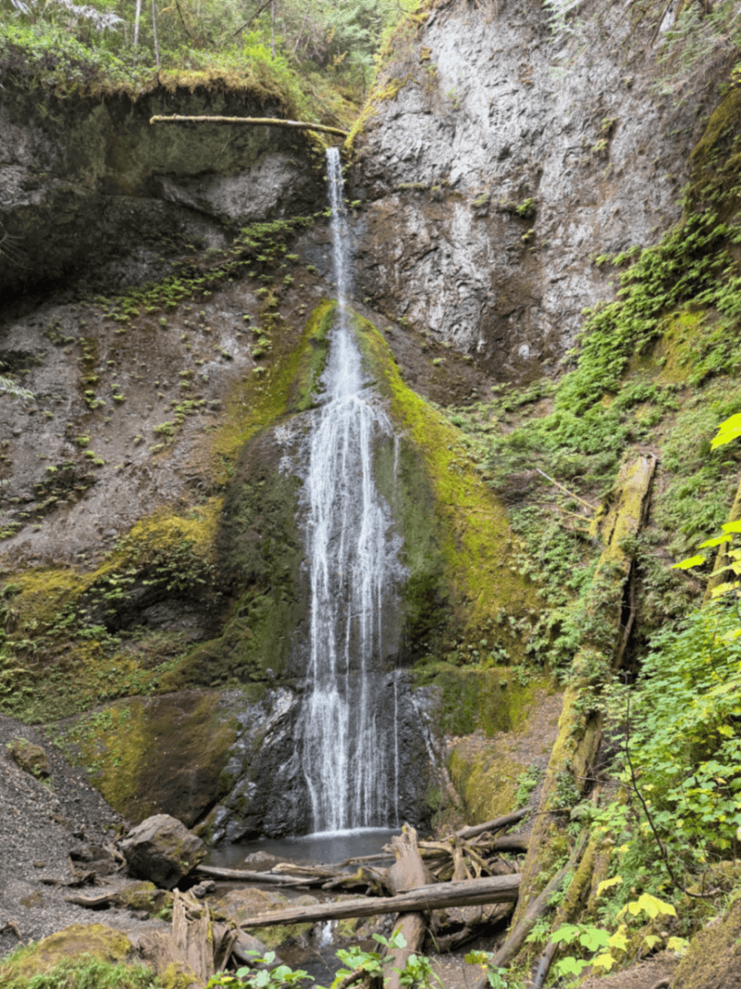
The lake is glacially carved, ringed by second-growth and old-growth forest, and largely undeveloped apart from a ranger station, a small campground, and the trailhead. It's quiet in a way that feels earned, mostly because getting here requires real commitment on a dead-end road with no services at the far end.
Why Lake Ozette matters
Lake Ozette is the access point for Cape Alava, the westernmost point in the contiguous United States, and for one of the best-preserved stretches of wilderness coastline in the Lower 48. The hike that connects the two, the Ozette Triangle, is often cited as a sampler of everything the Olympic coast does well: old cedar boardwalk through bog forest, a wild beach with sea stacks, and a direct link to Makah cultural history at Wedding Rocks. Few places let you do all of that in a nine-mile loop that most reasonably fit hikers can complete in a day.
Quick facts
- Location: Ozette Lake, within Olympic National Park, Clallam County, Washington
- Lake size: third largest natural lake in Washington
- Main trail: the Ozette Triangle, a loop of a little over nine miles
- Trail structure: roughly three miles of cedar boardwalk to Cape Alava, three miles of beach south to Sand Point, three miles of boardwalk back to the trailhead
- Cape Alava: the westernmost point in the contiguous United States
- Notable feature: Makah petroglyphs at Wedding Rocks, on the beach leg between Cape Alava and Sand Point
- Access road: a long, narrow spur off Highway 112, with no fuel or cell signal at the end
Getting there
You reach Lake Ozette by turning off Highway 112, the coastal road that runs along the Strait of Juan de Fuca between Port Angeles and Neah Bay. The turnoff leads down a long, narrow road with tight curves and little room to pass, so plan on taking it slowly, especially if you're towing anything or driving after dark. There is no gas station, store, or cell reception once you reach the lake, so fill up and let someone know your plans before you leave Sekiu or Clallam Bay.
Most people treat this as a half-day drive from Port Angeles, longer if you stop along the strait. Because the road dead-ends at the lake, there's no through-traffic and no shortcut out if you forget something.
The layout and experience
The Ozette Triangle starts and ends at the same trailhead near the ranger station on the lake's north shore. Most hikers go counterclockwise, taking the boardwalk to Cape Alava first and finishing on the beach, though it works in either direction.
The forest legs are almost entirely elevated cedar boardwalk, built to carry foot traffic over bog and dense understory without a maintained dirt trail eroding the wetland beneath it. It's flat, shaded, and quiet, but the wood is narrow in places and becomes genuinely slick when wet, which on this part of the coast is most of the time. Moss and rain have claimed more than a few ankles here. Walk it slower than feels necessary, especially on the sections with any lean or camber.
The beach leg between Cape Alava and Sand Point is the wild card. It's scenic, with driftwood logs the size of rail cars and headlands you have to scramble or wade around depending on the tide, but it is genuinely tide-dependent. Several sections are impassable at high water, and the posted alternate routes over headlands are not casual bypasses. A current tide table isn't a nice-to-have on this hike, it's a requirement, and you should plan your beach crossing around a falling or low tide rather than hoping it works out.
Main highlights
Cape Alava itself is a low, grassy point facing open ocean, marked more by its position than by any dramatic landform. Standing there, you're at the farthest west you can get in the Lower 48, which is a strange kind of landmark, no monument, just driftwood and wind and a line on the map.
Wedding Rocks, roughly midway along the beach section, holds one of the most significant groups of Makah petroglyphs on the Washington coast, carved into shoreline boulders. Figures include faces, whales, and what are generally read as ceremonial or narrative scenes. They sit on ancestral Makah land and are considered irreplaceable cultural heritage, not roadside curiosities. Look, photograph if you want, and do not touch or trace them. Oils and friction from hands degrade the rock faster than weather does.
Sand Point, the southern corner of the triangle, is a broader stretch of beach and a popular spot for backcountry camping if you're doing the hike as an overnight rather than a day trip. It also has its own boardwalk connection back to the main trailhead if you want a shorter out-and-back instead of the full loop.
History and background
Cape Alava was the site of a Makah village, and in the late 1960s a storm exposed wooden house planks that had been buried, apparently by a mudslide, several centuries ago. The resulting excavation, led by Washington State University archaeologist Richard Daugherty starting around 1970, became one of the most significant archaeological digs in North America, the mud having sealed and preserved organic material, baskets, tools, even wooden house posts, that normally would have rotted away. Many of the recovered artifacts are now held at the Makah Cultural and Research Center in Neah Bay, which is worth visiting if the dig interests you, since almost nothing of it remains visible at the site itself today.
The petroglyphs at Wedding Rocks predate written record and are part of the same Makah cultural landscape. Hiking the Ozette Triangle, in other words, is not just a scenic coastal walk, it passes directly through a documented center of Makah history and continuing cultural significance.
Tickets and entry
Lake Ozette is inside Olympic National Park, so a park entrance pass applies. Overnight backpacking on the Ozette Triangle requires a wilderness camping permit, issued through the National Park Service's backcountry permit system, and campers are generally required to use bear-resistant food canisters, which can sometimes be borrowed at the ranger station. Day hikers don't need a separate permit beyond the park entrance fee, but it's worth checking current NPS requirements before you go, since backcountry quota systems and permit procedures for the Olympic coast have changed in recent years.
Best time to visit
Summer and early fall bring the most stable weather and the longest daylight, which matters if you're timing the beach crossing around tides. Spring and winter are wetter, the boardwalk gets even more treacherous, and storms off the Pacific can make the coastal leg genuinely unsafe. Whatever the season, check the tide table for the day you plan to hike, not a generic seasonal average. The difference between a two-foot low and a five-foot high at the headland crossings is the difference between an easy scramble and a dangerous one.
Facilities and preparation
There's a ranger station near the trailhead and a small lakeside campground, but once you're on the trail there's nothing: no water sources you should rely on without treatment, no cell signal, no resupply. Bring more water than you think you need, a real tide table printed or saved offline, and good traction footwear for the boardwalk sections. If you're camping at Sand Point or Cape Alava, a bear canister is typically required and worth picking up in advance if the ranger station doesn't have loaners available when you arrive.
Combining with nearby attractions
Neah Bay and the Makah Cultural and Research Center sit roughly an hour's drive northwest, at the end of the same general stretch of Highway 112, and pair naturally with a visit to Wedding Rocks since the museum holds artifacts from the same cultural tradition. Cape Flattery, the northwesternmost point of the contiguous US, is also near Neah Bay and makes a logical second stop if you're already out this far. Heading back toward Port Angeles, Lake Crescent and the Elwha Valley offer a very different, more developed slice of Olympic National Park if you want contrast after a day on the remote coast.
Sample visit plan
- Arrive at the Ozette trailhead early, ideally timed so your beach crossing falls on a dropping or low tide
- Hike the three miles of boardwalk out to Cape Alava, stopping to take in the westernmost point
- Walk the beach south toward Sand Point, pausing at Wedding Rocks to view the petroglyphs
- Pick up the boardwalk at Sand Point for the return three miles to the trailhead
- Budget most of a day for the full loop, more if you stop to photograph or wait out a tide
Practical tips
- Bring a current tide table. The beach leg is impassable in places at high water
- Treat the boardwalk with real caution when wet, which is most of the time on this coast
- Do not touch or trace the petroglyphs at Wedding Rocks. Look and photograph only
- Fuel up and tell someone your plan before heading down the access road. There's no gas station or cell signal at the lake
- Pack out everything and bring a bear canister if you're camping overnight on the beach
FAQ
How long does it take to hike the Ozette Triangle?
Most hikers in reasonable shape complete the full nine-plus-mile loop in a single day, typically six to eight hours including stops at Cape Alava and Wedding Rocks. Tide timing on the beach leg can add waiting time, so build in a buffer rather than cutting it close.
Do I need a permit to hike at Lake Ozette?
Day hikers need the standard Olympic National Park entrance pass but no separate hiking permit. If you plan to camp overnight at Sand Point or Cape Alava, you'll need a wilderness camping permit through the park's backcountry system, and a bear canister is generally required.
Can I touch or take rubbings of the petroglyphs at Wedding Rocks?
No. The petroglyphs are irreplaceable Makah cultural heritage on ancestral Makah land. Touching, tracing, or making rubbings damages the rock surface and is not permitted. Photograph them respectfully and leave them exactly as you found them.
Is the Ozette Triangle hike dangerous?
It's manageable for most fit hikers but not casual. The boardwalk is slippery when wet and has caused broken ankles, and parts of the beach section become impassable at high tide. Check a tide table before you go and wear shoes with real grip.
Is there gas or cell service at Lake Ozette?
No. The access road off Highway 112 ends at the lake with no fuel station and no reliable cell signal. Fuel up in Sekiu or Clallam Bay beforehand and let someone know your hiking plans in advance.
Reviews
Sign in and mark this place visited to leave a review.
No reviews yet.
Free Trip Planner
Plan your Olympic National Park trip with our free planner
Build a day-by-day itinerary with AI suggestions, hand-picked places, and friends. Free forever — no credit card.