Upper Rock Nature Reserve
Nature Reserve, Gibraltar GX11 1AA Posted by Brandon B.Admin
Overview
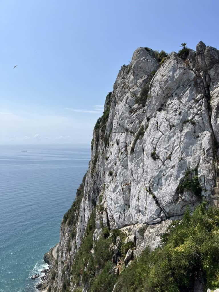
Upper Rock Nature Reserve sits at the summit of the Rock of Gibraltar, the iconic limestone monolith that dominates the peninsula's skyline. This 1,440-foot natural landmark has been a strategic vantage point for centuries and today functions as a protected nature reserve with walking trails, historical fortifications, and sweeping views across the Mediterranean and North Africa. The reserve spans approximately 40 hectares and draws visitors for its geology, wildlife, and the sheer drama of the location itself.
What makes Upper Rock distinct is not just the elevation but the layering of experiences within it. You'll encounter Barbary macaques on the slopes, explore caves that have been inhabited for thousands of years, and walk past World War II gun emplacements and earlier military infrastructure. The reserve is managed to preserve both its natural ecology and its tangible history.
Why this place matters
Upper Rock is Gibraltar's most visited natural attraction and for good reason. It's one of only two habitats in the world where Barbary macaques live in the wild. The reserve also contains St. Michael's Cave, a cathedral-like cavern with archaeological evidence of human occupation dating back millennia. For military history enthusiasts, the tunnels and gun positions carved into the rock during sieges and wars offer a different kind of storytelling than you'll find in conventional museums.
The reserve functions as a living archive. Its geology tells the story of the Strait's formation. Its macaque population is closely monitored and has become a symbol of Gibraltar's conservation efforts. And its fortifications represent centuries of power struggles in one of the world's most strategically sensitive regions.
Quick facts
- Height: 1,440 feet above sea level
- Reserve size: Approximately 40 hectares
- Wildlife: Barbary macaques, along with Barbary partridge and various Mediterranean plant species
- Main entry point: Usually accessed via cable car or on foot from Main Street
- Time needed: 2 to 4 hours depending on which attractions you visit
- Cable car: Operates most days, weather permitting
- Ticketing: Tiered entry options; cable car typically included with reserve admission
Getting there
Most visitors arrive via the cable car, which departs from the lower station on Main Street in central Gibraltar. The journey takes approximately 6 minutes and deposits you near the top of the rock. On clear days, the views during ascent are worth the ride alone. You can see across to the Rif Mountains in Morocco and down into the Strait.
If you prefer to walk, several footpaths ascend the rock from different starting points. The route from Willis's Battery or the path starting near the Moorish Castle takes longer but allows you to move through the reserve at your own pace and see more of the flora and fauna. Allow 45 minutes to over an hour for the walk depending on fitness and your chosen route.
The cable car runs most days but closes during high winds or poor visibility. If weather is uncertain, check status before committing to the journey. The lower station is a 10 to 15 minute walk from the city center if you're staying downtown.
The layout and experience
Once you arrive at the top (either by cable car or on foot), you're in a landscape that feels removed from the towns below. The reserve is organized around several interconnected zones, each with its own character and focus.
Near the cable car station, you'll find viewing platforms with interpretive panels explaining the rock's geology and the Strait's strategic importance. These platforms are where most visitors spend their first minutes taking in the panorama. The layout is intuitive enough that you can wander the main paths without a map, though one helps you understand what you're seeing.
The Barbary macaque population roams across the upper slopes. You're likely to encounter them if you walk any distance into the reserve. They're habituated to human presence but remain wild animals. The wardens and signage make clear what distances to maintain and how to behave around them. Feeding is prohibited.
St. Michael's Cave requires a separate entry and is reached via a marked path that takes about 15 minutes on foot from the main plateau. The cave is genuinely cavernous and has been used as a mosque, a church, a hospital, and a concert venue at different points in history. It feels substantial in a way that photographs don't quite convey.
The military structures are scattered throughout. You'll see the remains of gun emplacements, barracks foundations, and tunnels. Many tunnels are closed to the public for safety reasons, but some sections are open or partially visible. The historical markers explain their purpose and date.
Main highlights
St. Michael's Cave is the most visited single feature within the reserve. The main chamber is cathedral-like in scale with stalactites hanging from the ceiling and pools of still water on the floor. The cave descends in multiple levels. The upper sections are accessible to most visitors, though some areas require negotiating stairs and uneven ground. Photography inside reveals the scale better than the human eye sometimes does in the dim light.
The Barbary macaques are the other major draw. Seeing them in their natural habitat is a privilege. They're active in early morning and late afternoon generally. Midday heat sends them into shaded areas, so timing your visit accordingly increases sighting chances. Even if you don't see them, the knowledge that you're walking through their home adds weight to the experience.
The views from the upper plateau stretch across three countries on a clear day. You see Spain to the north, Morocco to the south, and the Atlantic beyond. The vantage point makes the geopolitical significance of the Rock tangible in a way that reading about it never does.
The 100-Ton Gun, a Victorian-era cannon installed in 1884, sits in a carved gun emplacement. It's a striking artifact and speaks to the industrial scale of 19th-century military engineering.
History and background
The Rock of Gibraltar has been inhabited since at least the Pleistocene era. Neanderthal remains and tools have been found in caves here, making it one of the last known Neanderthal habitats in Europe. The cave sites remain archaeologically significant.
In the medieval period, the rock became a fortress. The Moors built the Moorish Castle (lower down the slope) in the 8th century. The name Gibraltar itself derives from the Arabic "Jebel Tariq," meaning Mountain of Tariq, after the Berber general who crossed from North Africa in 711. The strategic location made it valuable to every power that could hold it.
The British captured Gibraltar in 1713 under the Treaty of Utrecht and have held it since, despite Spain's repeated claims. The 18th and 19th centuries saw intensive fortification. Tunnels were carved into the rock during the Great Siege of 1779 to 1783. These tunnel systems expanded dramatically during World War II, when Gibraltar served as a crucial military base and the rock became honeycombed with defensive positions, storage facilities, and barracks.
The Barbary macaque population has fluctuated over centuries. By the 1950s, only about a dozen remained. A successful breeding and protection program has increased numbers to around 250 today, making Upper Rock crucial to the species' survival.
Tickets and entry
Entry to Upper Rock Nature Reserve is ticketed. A single admission ticket typically covers access to the reserve, the cable car (or a cable car discount if you walk), and St. Michael's Cave. There are also walking-only options if you prefer not to use the cable car.
Tickets are purchased either at the cable car station or at the reserve entrance. Online booking is available and sometimes offers modest discounts or convenience. Children usually receive reduced rates, and family bundles exist.
St. Michael's Cave is included in the reserve admission. Some special areas or guided tours may incur additional fees, but the main attractions are covered under general admission.
Best time to visit
Spring and autumn offer the most comfortable weather. Temperatures are mild, and the light is rich for photography. Winter is cool and can be rainy, which limits visibility and makes walking slippery. Summer heat is intense at that elevation, and the cable car sometimes closes during extreme heat due to operational constraints.
Visit early in the morning if you want the best chance of seeing Barbary macaques and avoiding crowds. Late afternoon light is excellent for photography but tends to draw more visitors. Midday is hottest and most crowded.
Weather can change rapidly. Fog can roll in suddenly and obliterate the views. If you see clear skies, don't delay your visit. The cable car shuts down in winds exceeding certain thresholds, so planning flexibility is wise.
Photography tips
The panoramic views are best captured early or late in the day when the sun is lower and colors are warmer. Midday light is harsh and flattens the landscape. Bring a wide-angle lens if you want to capture the scale of the views across the Strait.
Inside St. Michael's Cave, a tripod and high ISO are useful because natural light is limited. The stalactites and pools photograph well with careful exposure. Avoid using flash directly on the formations as it can be harsh and disorienting in the dark.
Macaques are best photographed with patience and a longer lens. Getting too close disrupts them and violates the reserve rules. Early morning light filtering through trees where they feed creates excellent conditions for wildlife photography.
Facilities and preparation
There are refreshment facilities near the cable car station and at a couple of spots on the main plateau. Prices are higher than town but not dramatically so. Bringing water is still a good idea, especially if you plan to walk trails away from the main area.
Wear sturdy walking shoes. The paths are maintained but uneven in places, and some areas have loose stones. The elevation means weather can be different from lower town. Bring a light layer even in summer as wind at the top can be cool.
There are benches and sheltered areas throughout the reserve where you can rest. Restroom facilities exist near the main plateau area. The paths are generally well-marked, but it's possible to take wrong turns if you venture into less-traveled areas.
Sun protection is important. There's limited shade on the open plateau, and reflection off the white limestone intensifies UV exposure. Hat and sunscreen are recommended year-round.
How it compares to similar places
Upper Rock differs from typical nature reserves by layering natural habitat, archaeological significance, and military history. It's not purely a wildlife viewing destination like some African reserves, nor is it purely historical like a castle or fort. The combination is what makes it distinctive.
The cable car experience is comparable to rides in other Mediterranean locations, but the views and the reserve itself are specific to Gibraltar. If you've visited other high-elevation fortified sites, you'll recognize the military engineering patterns here, though the scale and preservation are particular to this place.
Combining with nearby attractions
The Moorish Castle sits lower on the rock's slope and is accessible from Upper Rock via a hiking path. It's worth adding to your itinerary if you have time. The journey between the two takes about 30 to 45 minutes depending on your pace.
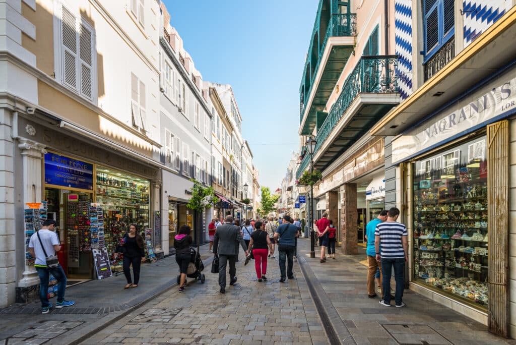
Main Street in town has shops, restaurants, and cafes where you can eat before or after your reserve visit. The cable car station is steps from the street, making it easy to move between urban exploration and the reserve.
The Lower Rock fortifications and tunnels are not part of the nature reserve but are accessible via separate tours. If military history fascinates you, combining a reserve visit with a tunnel tour gives you more complete coverage of Gibraltar's defensive systems.
Sample visit plan
Arrive at the cable car station early, ideally by 9 AM. Purchase your ticket and ride to the top. Spend your first 20 to 30 minutes at the viewing platforms getting oriented and enjoying the panorama across the Strait.
Walk the main plateau paths for about an hour, looking for Barbary macaques and exploring the various viewpoints and historical markers. Then head toward St. Michael's Cave. Allocate 45 minutes to explore the cave thoroughly. The descent into lower chambers takes time, and the lighting rewards patience.
If energy and time allow, walk one of the longer trails back toward the Moorish Castle or explore other sections of the reserve. Otherwise, return to the cable car station by early afternoon. The full circuit, including the cable car journey, takes 3 to 4 hours comfortably.
Practical tips
- Check cable car status before visiting, especially in winter or windy weather
- Bring more water than you think you'll need
- Wear sunscreen and a hat even on cloudy days
- Visit early morning for better macaque sightings and fewer crowds
- Keep a safe distance from macaques, no matter how docile they appear
- Do not leave food or trash unattended; macaques will investigate
- The paths are safe but uneven in places; good footwear matters
- Allow extra time if you want to explore beyond the main plateau
- Photography is permitted throughout the reserve
FAQ
Is it safe to encounter the Barbary macaques? Yes, they're habituated to humans and generally ignore visitors if you maintain distance and don't offer food. They're wild animals, not pets, and should be treated with respect and caution. The reserve wardens can provide specific guidance.
Can I visit Upper Rock if I'm not very fit? Yes. The cable car gets you to the main plateau with no walking required. From there, the main paths are gentle and well-maintained. St. Michael's Cave involves stairs, but you can control your pace. Visitors of varying fitness levels visit regularly.
How long does a typical visit take? Most people spend 2 to 3 hours, including the cable car ride, main plateau exploration, and St. Michael's Cave. You can do it in 90 minutes if you're rushed, or spend a full day if you explore the longer trails and rest frequently.
Is the reserve accessible year-round? The reserve is open year-round, but the cable car closes during high winds or poor visibility. Winter weather can limit visibility and make some paths slippery. Spring through early autumn offers the most reliable conditions.
Can I bring a picnic? Yes. There are designated rest areas and benches where eating is permitted. However, all rubbish must be removed as the macaques will investigate any food waste left behind.
Opening hours
Reviews
Sign in and mark this place visited to leave a review.
No reviews yet.
Free Trip Planner
Plan your Gibraltar trip with our free planner
Build a day-by-day itinerary with AI suggestions, hand-picked places, and friends. Free forever — no credit card.