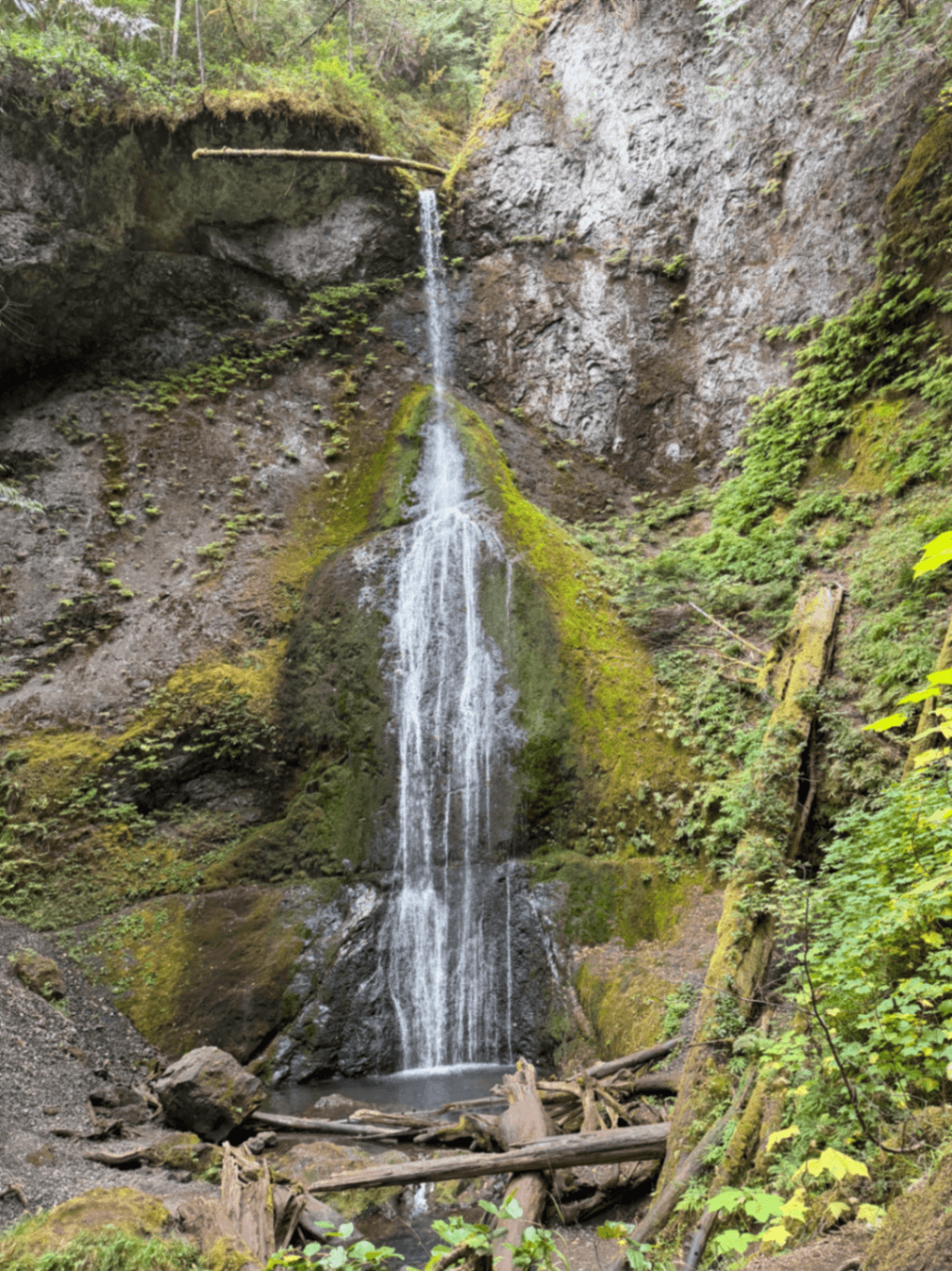
Quinault Rain Forest sits in the southwest corner of Olympic National Park, in the valley carved by the Quinault River on its way to Lake Quinault. It gets called the Valley of the Rain Forests, plural, because the designation here isn't limited to one famous trail the way the Hoh Rain Forest is. It's a whole watershed, moss-hung and dripping most of the year, and it happens to see a fraction of the visitors that pile into the Hoh's parking lot forty-some miles north. If you want the same towering Sitka spruce and hemlock canopy, the same sword fern and oxalis carpeting the forest floor, without circling a full parking lot at 9am in July, this is the place to come instead.
The valley is also unusual in how it's governed. Depending on where your boots are standing, you might be in Olympic National Park, Olympic National Forest, or on Quinault Indian Nation land. The boundaries aren't always obvious on the ground, and the rules change with them. A national park pass that covers one pullout won't necessarily cover a trailhead a mile down the road. It's worth reading the signage at each stop rather than assuming blanket coverage.
Why Quinault Rain Forest matters
This is one of only a handful of temperate rain forest valleys left in the lower 48, and the Quinault watershed is often overshadowed by the Hoh simply because the Hoh has the bigger reputation and the easier access from Highway 101. That obscurity is Quinault's advantage. The trees are just as old, the understory just as thick with licorice fern and club moss, and the Quinault valley adds something the Hoh doesn't have on the same scale: a genuine lake, ringed by a loop road, with a historic lodge anchoring the whole scene. It's rain forest and resort town rolled into one stop, which makes it easier to build a half-day or full-day visit around without feeling like you're only looking at trees.
Quick facts
- Location: South Shore Road, Quinault, WA 98575, within Olympic National Park's southwest section
- Loop road around Lake Quinault runs roughly 31 miles, crossing the Quinault River and reaching both the south and north shores
- South Shore is the developed side, with paved road and most visitor facilities
- North Shore is quieter, partly gravel, and sees far less traffic
- Home to record-sized trees, including a Sitka spruce that has been measured among the largest in the world
- Lake Quinault Lodge was built in 1926 and sits on the south shore with a lawn sloping to the water
- Land jurisdiction is mixed between the national park, Olympic National Forest, and the Quinault Indian Nation
Getting there
Most visitors reach the Quinault valley off US Highway 101, turning inland at the small junction town of Amanda Park or further south near Quinault itself. From there, South Shore Road takes you along the developed side of the lake, past the ranger station, the lodge, and the main interpretive trailheads. If you want the full loop, you'll cross the river near the lake's eastern end and come back along North Shore Road, which turns to gravel for stretches and moves much slower. Budget extra time for that section. There's no quick highway bypass once you're in the valley, so plan the drive as part of the day rather than a means of getting somewhere else.
The layout and experience
The lake itself is the organizing feature. Lake Quinault is a glacially carved body of water a few miles long, with the rain forest pressing right up to its shoreline on both sides. The south shore has the lodge, a handful of small lodges and cabins, a ranger station, and the trailheads most people use. The north shore feels different almost immediately once you cross the bridge: narrower road, fewer cars, forest crowding in closer. If you're used to the Hoh's single out-and-back trail and crowded Hall of Mosses loop, the spread-out nature of Quinault takes some adjusting to. There isn't one trail everyone does. Instead there's a scattering of short loops, pullouts, and a scenic drive that does a lot of the sightseeing work for you from the car.
Main highlights
The record trees are the headline draw for a lot of visitors. The Sitka spruce near the lake has been measured at or near the top of its species worldwide, and finding it is as much a reason to drive the loop as the lake views are. Signage along the road points toward several of these giants, though exact locations and measurements shift with storm damage and remeasurement over the years, so treat any specific numbers you hear from a sign as a snapshot rather than gospel.
For walking, the Maple Glade Trail on the north side is a short, easy loop through big-leaf maple draped in moss, a good introduction to the kind of green-on-green density that defines these forests. The Quinault Rain Forest Nature Trail, closer to the south shore facilities, covers similar ground in an even shorter loop and works well if you're traveling with kids or limited on time. Neither trail demands much more than sturdy shoes and twenty or thirty minutes.
Lake Quinault Lodge deserves its own mention as a highlight rather than just a place to sleep. Built in 1926, it's a large timber lodge with a stone fireplace in the lobby and a lawn that runs straight down to the water. It's open to visitors even if you're not staying the night, and the lakeside lawn is a pleasant spot to sit after a hike.
History and background
The lodge's most notable moment came in 1937, when Franklin D. Roosevelt stopped for lunch during a tour of the Olympic Peninsula. Local advocates used the visit to push the case for permanent federal protection of the old-growth forests and alpine country further north. Roosevelt signed the bill creating Olympic National Park the following year, in 1938. The Quinault valley itself, though, sits partly outside the park boundary proper, which is why you'll find national forest land and Quinault Indian Nation territory woven through the same drive. The Quinault people have lived in this watershed for a very long time, and the reservation here predates the park by decades. That layered ownership is a direct legacy of how the park's boundaries were drawn around existing communities and resource lands rather than over them.
Best time to visit
Rain forest means rain, and the Quinault valley gets a lot of it, often over 100 inches a year by most accounts of the region's climate, concentrated heavily in the cooler months. Summer, roughly July through early September, gives you the best odds of dry trails and clear lake views, and it's also when the lodge and campgrounds are busiest, though still nowhere near Hoh-level congestion. Spring and fall bring more rain but also fewer cars and a deeper quiet in the forest. Winter is moody and often wet enough that some of the gravel sections of North Shore Road get rough, so check conditions before attempting the full loop outside of summer.
How it compares to similar places
The obvious comparison is the Hoh Rain Forest, the peninsula's other famous valley and the one most first-time visitors default to. The Hoh has the more polished visitor center and the more famous short trails, but it also has the parking problem, with cars queuing down the access road on busy summer days. Quinault has no equivalent bottleneck. What it trades for that ease is a less curated experience. You won't find one single iconic trail that everyone does, and you'll need to piece together the lake loop, a couple of short trails, and the lodge grounds to get the full picture. For travelers who've already done the Hoh and want more rain forest without the repeat crowd, or for those who'd rather build a day around a drive and a lake than a single trailhead, Quinault is the better fit.
Combining with nearby attractions
Quinault sits close enough to the Pacific coast that a combined day is realistic, with the beaches near Kalaloha reachable within an hour or so of driving. It also pairs naturally with a Hoh Rain Forest visit if you're making a longer loop around the peninsula's west side, since both sit off Highway 101 within a couple hours of each other. If you're coming from the south, Grays Harbor and the Washington coast towns around Ocean Shores and Westport make a reasonable staging point before heading up into the valley.
Sample visit plan
Arrive via South Shore Road and start at the ranger station for any current trail or road condition updates, since gravel sections and storm damage can change year to year. Walk the Quinault Rain Forest Nature Trail or the Maple Glade Trail first, while you've got energy for photos in good light. Drive the loop road clockwise, stopping for the marked record trees and any lake pullouts that catch your eye. Cross to the north shore for a slower, quieter stretch of driving, then finish back at the lodge for a late lunch or coffee on the lawn facing the water. The whole loop with stops can comfortably fill most of a day without feeling rushed.
Practical tips
- Check signage at each trailhead and pullout rather than assuming your national park pass applies, since jurisdiction shifts between park, national forest, and tribal land
- Expect gravel and slower driving on parts of North Shore Road, especially after rain
- Bring layers and rain gear regardless of season; this is a genuine rain forest climate
- Fuel up before you arrive, since services in the valley are limited
- Visit midweek in summer if you want the already-light crowds even thinner
- The short interpretive trails are suitable for most fitness levels and families with young kids
FAQ
Is Quinault Rain Forest part of Olympic National Park?
Partly. The valley overlaps Olympic National Park, Olympic National Forest, and Quinault Indian Nation land, so rules and any required permits can differ depending on exactly where you're standing. Check posted signage at each stop.
How does Quinault compare to the Hoh Rain Forest?
Both have old-growth conifers, moss, and similar understory, but Quinault draws far fewer visitors and doesn't have the Hoh's parking congestion. In exchange, the Hoh has a more concentrated, well-marked visitor experience, while Quinault spreads its highlights across a lake loop, record trees, and a historic lodge.
Can you drive all the way around Lake Quinault?
Yes, a loop road of roughly 31 miles circles the lake, crossing the Quinault River and linking the paved South Shore Road with the quieter, partly gravel North Shore Road.
Is Lake Quinault Lodge open to non-guests?
Yes, the lodge and its lakeside lawn are open to visitors even if you're not staying overnight, and it's a reasonable stop for a meal or a break after walking one of the nearby trails.
What is the biggest tree in the Quinault valley?
A Sitka spruce near the lake has been measured among the largest of its species anywhere in the world, and it's marked along the loop road, though exact size rankings can shift with remeasurement over time.
Reviews
Sign in and mark this place visited to leave a review.
No reviews yet.
Free Trip Planner
Plan your Olympic National Park trip with our free planner
Build a day-by-day itinerary with AI suggestions, hand-picked places, and friends. Free forever — no credit card.